

The field visit program for the Geophysical Survey (VES) was conducted by the team comprising of Geophysicist, Geologist, Technical Assistants and Local Labors.
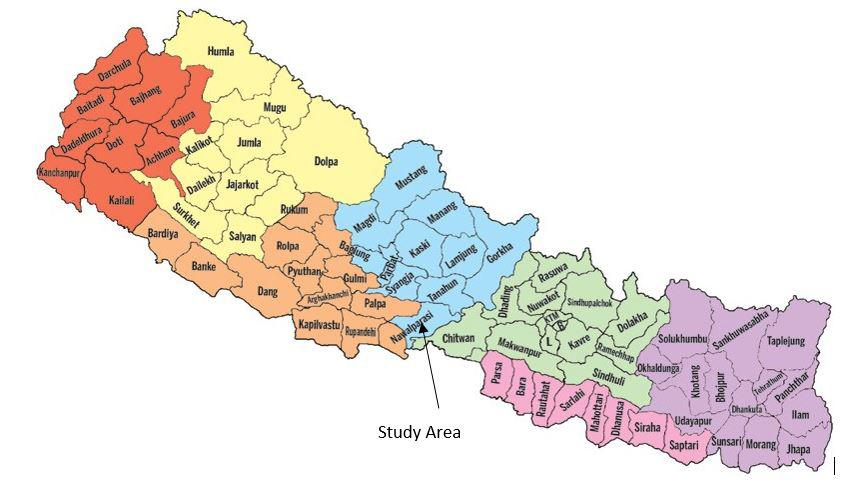
The present study area is located at the ward no. 3 of the Nawalpur East District Provision No. 4, Nepal. Figure 1 shows the location map of the study area. The Geographical location of the central point of the study area for VES is 27°41'3.07"N, 84°12'9.15"E and 194 amsl. The site is easily accessible by the black topped road, feeder road to Mahendra Highway.
In ward no. 3 of Devchuli Municipality of Nawalpur East District, Provision No.4 Vertical Electrical Sounding was carried out for the purpose of extraction of groundwater for irrigation. The main objective of the present geophysical exploration is to get hydrogeological information of the area so that one will be able to decide whether or not groundwater may be exploited for irrigation. In order to meet the objectives, the scopes of works are as follows:
Review and conduct general geological survey of the area
Carryout Resistivity survey (VES) is the given area
Compute, analyze and interpret the field data with computer added software.
Make suggestion and recommendations on hydrogeological condition through geophysical, geological observations.
Figure 1 Location Map of the Study area

Industry-leading geophysical equipment and service provider supplier